Einsiedeln hike
Now that the weather is better, I’ve been itching to hike. I usually do my daily walk part way up Uetliberg then back down, and a few weekends ago it was really nice so I hiked all the way up and back for the first time since last hiking season. So last weekend when the weather was nice, we took off on our first warm-up hike of the season.
I’ve found a hiking group that’s based here in Zürich, and they have websites where they create hike events and allow you to sign up to attend. I haven’t been brave enough to actually go on a hike with them because I’m the slowest hiker on the planet, and I know I would seriously cramp their young, fit, expert-hiker style. But I use their group as a resource for finding good hikes that are close to Zürich, because that’s where the majority of their excursions happen.
Last weekend, Cass had Friday off as a company holiday, so I decided that we needed to go hike. The hiking buddies group had recently been to Einsiedeln on a hike, so I figured out how to download their map onto my hiking app. We hopped on the train, and about 45 minutes later we were pulling into Einsiedeln.
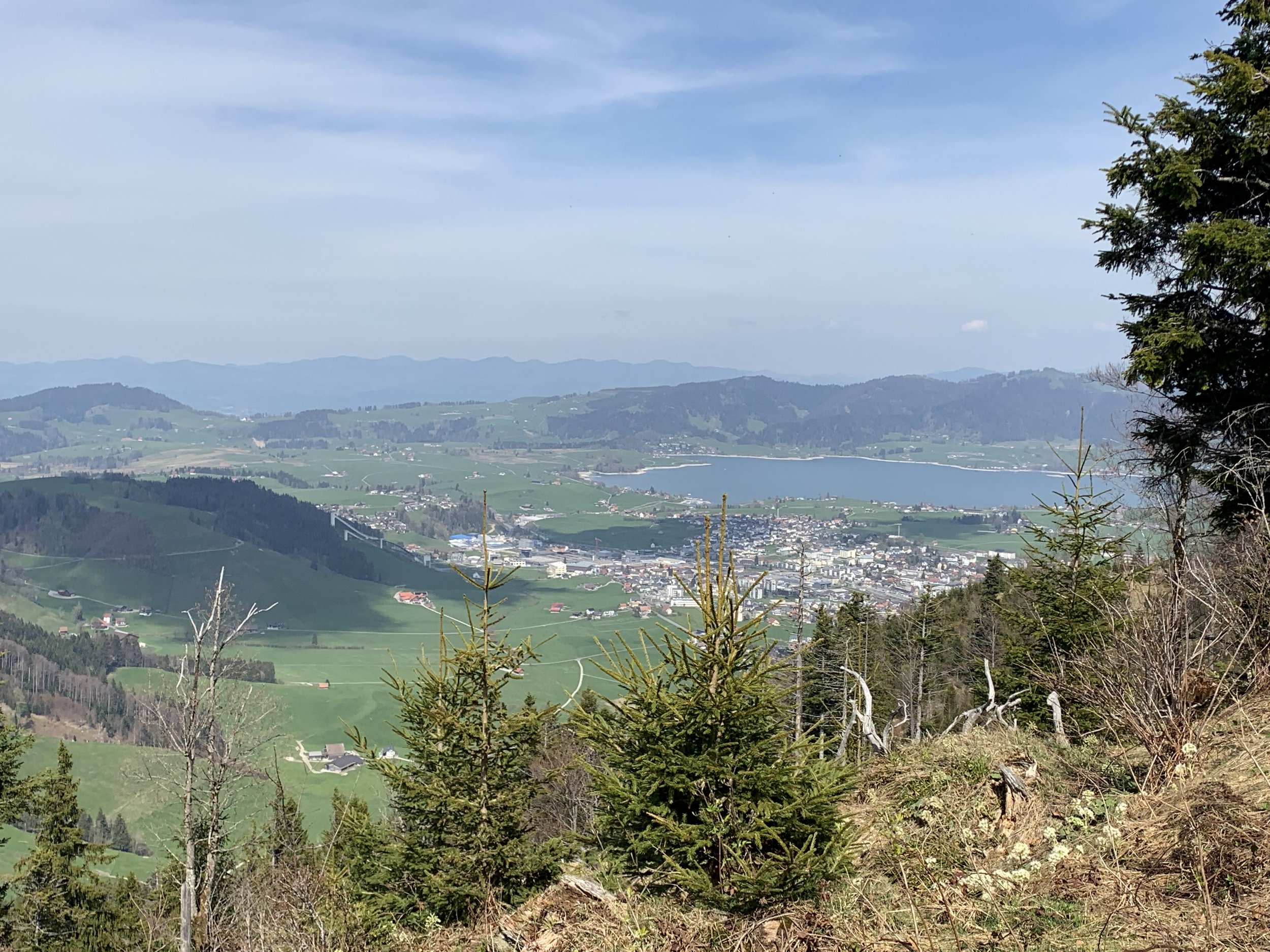
First pic is from the train, and the third pic shows the “mountain” where we hiked up as we were approaching it on the trail. The fourth pic is the village of Einsiedeln from the trail going up the mountain.


The hiking buddies map wasn’t exactly correct, so we were off their trail pretty quickly. Luckily, there weren’t many paths to choose from, so low chance of us getting lost. Down at the bottom of the mountain, we got to hear some cowbells as we passed a farm. But as we got higher up, we quickly realized that we were near one of the Swiss military’s shooting ranges and that Friday afternoon was a busy day for shooting and exploding things. We even encountered some signage posted that warns hikers not to stray off the path or risk danger from stray ammunition. Oh joy.


When we made it up close to the peak, we stopped to rest and picnic. The views up until this point hadn’t been exactly worth it. It didn’t get much better at this point, but we enjoyed our break and the sound of rapid gunfire echoing through the area.
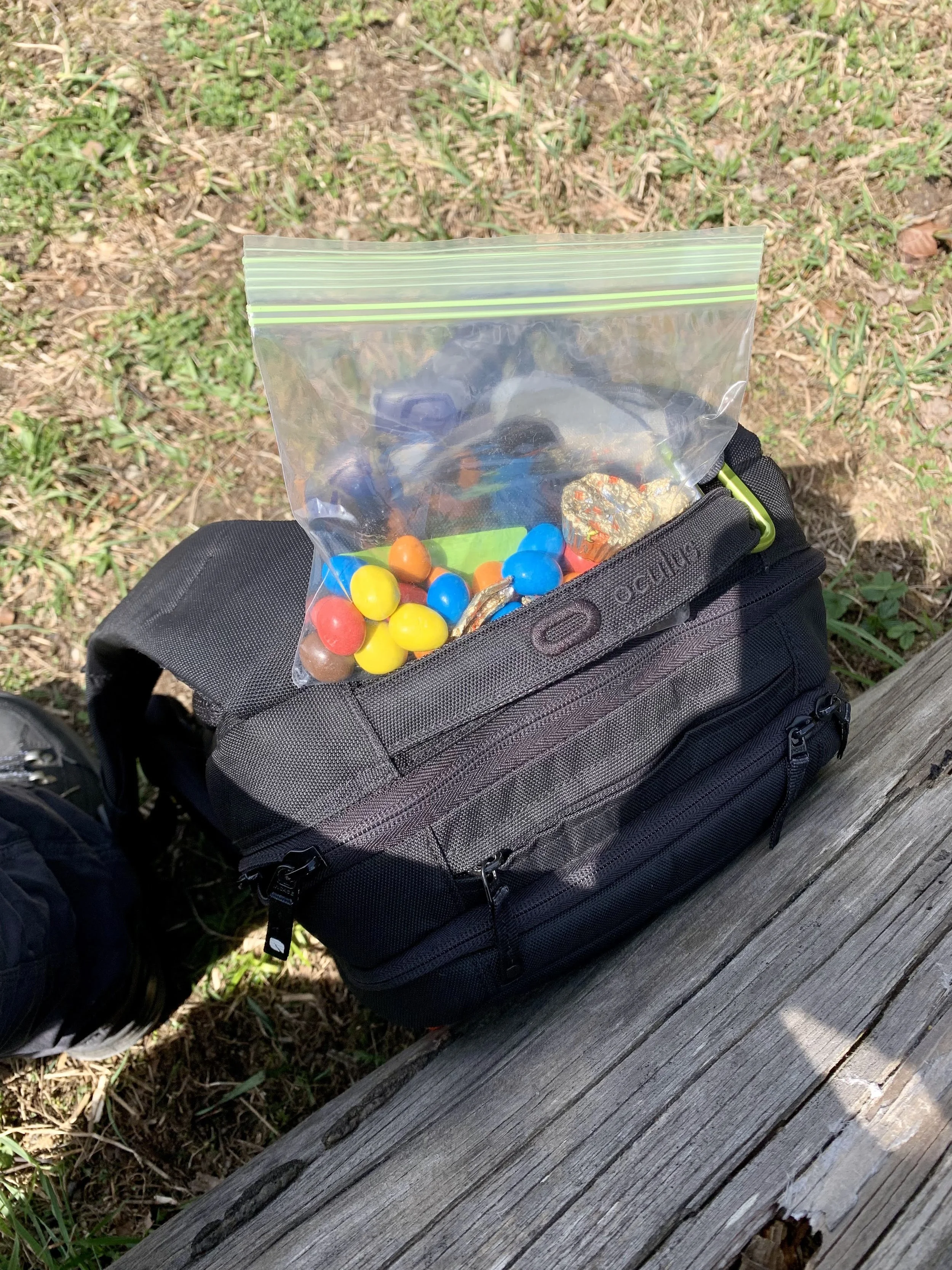
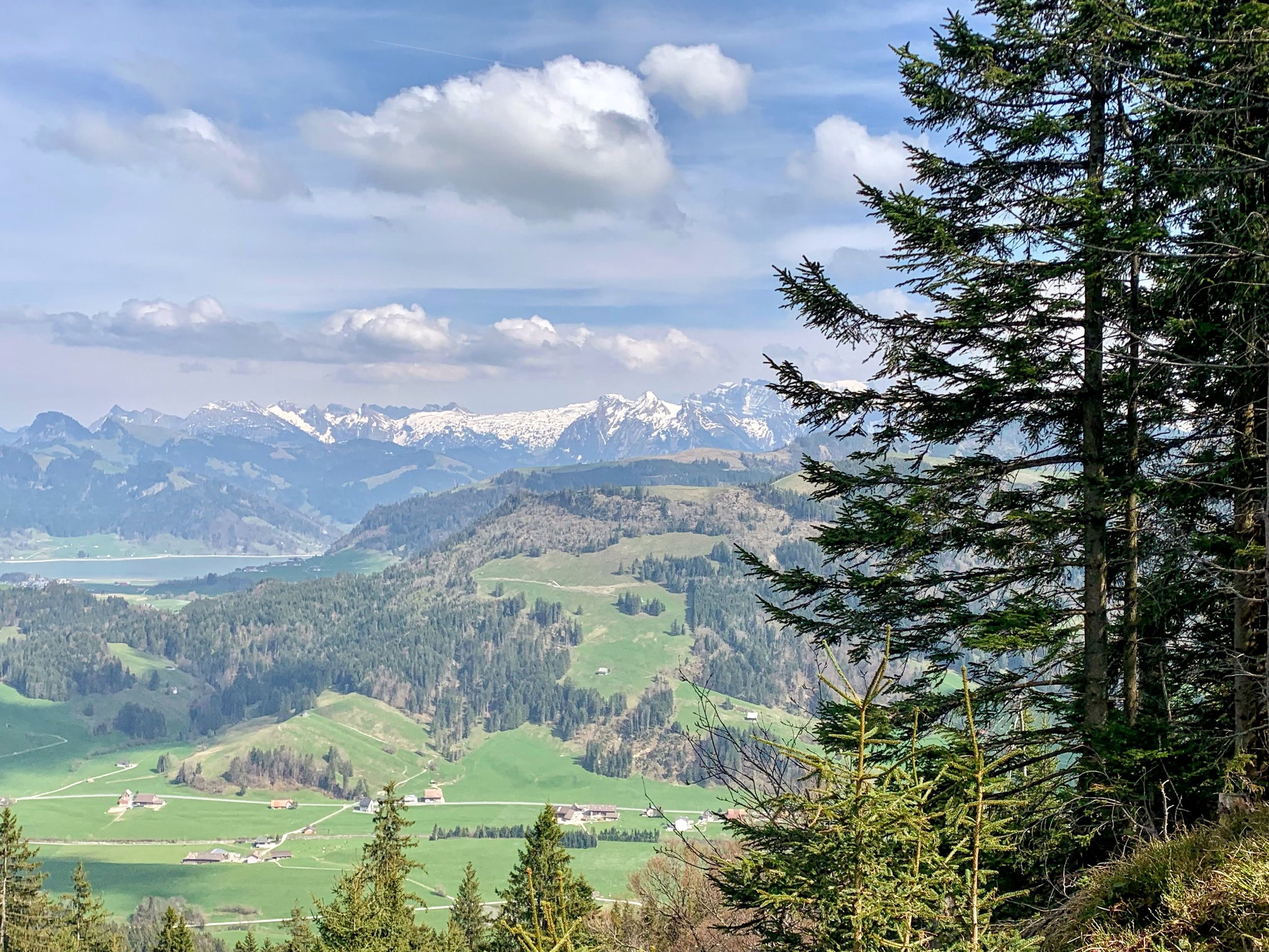
Then we headed up the last bit to the highest point, and then hiked along the ridge. The views definitely started to get better. There was a good bit of leftover snow, which made for a very muddy ridge hike. Part of the trail also followed along what is a cow pasture (with no cows right now bc the fencing was down), and there was signage telling you to make mama cows mad at your own risk. Along the way, we came upon a rest area of sorts with a really nice view and a picnic table. There was also a barbecue and firewood shed and even a makeshift WC consisting of a barrel with a toilet seat on top. There was an older man there drinking a beer, and he kept trying to hand us this ziploc bag while saying something in Swiss German. I don’t understand any Swiss German and we thought he was offering us food, so we just kept saying “Nein, danke, no thank you.” He finally gave up and walked over to put the ziploc bag in a metal container, closed it up, and drove off on a 4-wheeler. I went to check out what was in the box, and it turned out to be a guest book! I flipped through it a little bit, and then I signed it for us. It has apparently been there for a while, because it was nearly filled with notes and dates and signatures. Very cool. I’m sure that old man thinks we’re idiots though. LOL!


Instead of making a loop and ending up back in Einsiedeln like the hiking buddies route indicated, we ended up in the village of Trachslau. As we approached Trachslau, we quickly realized that we needed to hurry up and catch the bus back to Einsiedeln (to catch the train) or we’d have to wait an hour for the next one. But we made it and all was well. Met a cat on the way too.


